[Green] Infrastructure
|
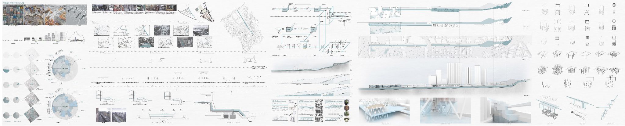
WHAT? GREEN INFRASTRUCTURE As an architectural tool, green infrastructure is a network providing city the ingredients for solving urban and climatic challenges by building with nature. Reviewing urban ecology’s potential role as an infrastructure, it is used to improve the urban deterioration. WHY? URBAN DETERIORATION Densification Cities may best respond by densification at existing transport nodes where the infrastructure can be readily upgraded. It is always easier to develop manageable tracts of land around transport interchanges at high density than it would be to spread medium density across the entire city. Heat Island Effect The rapid urbanization and the emergence of many mega cities trigger a number of environmental issues. The Urban Heat Island is one of the effects of urbanization. The UHI refers to the phenomenon that the temperature in the urban place is always higher than that in surrounding rural areas, especially at calm and cloudless night. The urban heat island is mainly caused by the storage of solar energy in the urban fabric during the day and release of the energy into the atmosphere at night. The process of urbanization and development alters the balance between the energy from the sun used for raising the air temperature (heating process) and that used for evaporation (cooling process). Imagining density is growing up and urban is deteriorating, what will the city actually look like and how will the city function if it continues to be urbanized, at the same time, to be cut off from the nature.
How? URBAN RIVER Rivers do have cooling effects and that future policies to uncover underground rivers could be of value in urban environments where high temperatures can have a negative effect on health and wellbeing. However, they stress that urban form surrounding the river corridor is more important than the simple presence or absence of a river and that cooling effects can be greatly enhanced by careful consideration of urban design. URBAN SCALE Wun Sha Street is picked as the site for carrying experiments of the effect of urban river to the urban. In the late 19th century, women carried out family-scaled cotton industries in Tai Hang. Wooden textile machines were used to weave clothes which had supplied families around the city. They used the stream water from the hills to bleach and wash the dyed cotton, thus Tai Hang was given the name Wun Sha Kai 浣紗溪 [Cotton Washing Stream]. The stream was channelized into a nullah in the late 19th century and part of the nullah was converted to underground drainage in the 1960s. The new urban planning included regular land lots, Tai Hang gradually moved away from the agricultural past. Soon after the new roads and streets were completed, European residential houses were built in this new district. Nowadays, residential buildings that were built in the early 20th century can still be found in Tai Hang. MICRO SCALE Research studies are mainly on technologies. Several technologies are undergoing experiments in order to investigate the effect of improving urban climate. Wind Recycling Technology in Clarke Quay Singapore, Water Recycling Technology in Cheonggyecheon Seoul and Water Quality Technology in Punggol Singapore are studied in principle and effect aspects.
URABN + MICRO In design stage, studies of technologies are applied into site context in order to improve the urban climate and heat island effect.
BIBLIOGRAPHY: |