Long- lasting Topography and Architecture
|
Long- lasting Topography and Architecture
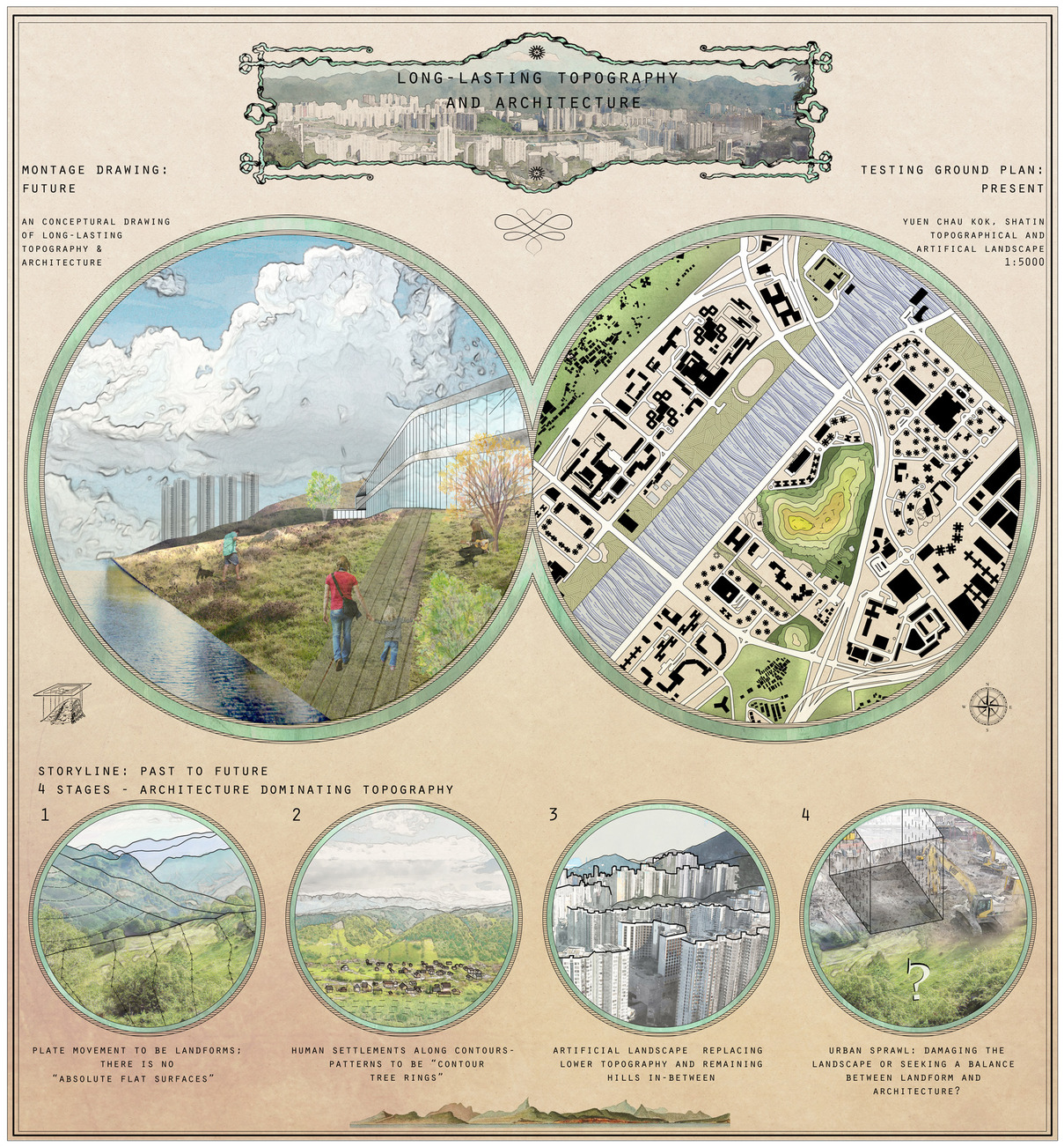
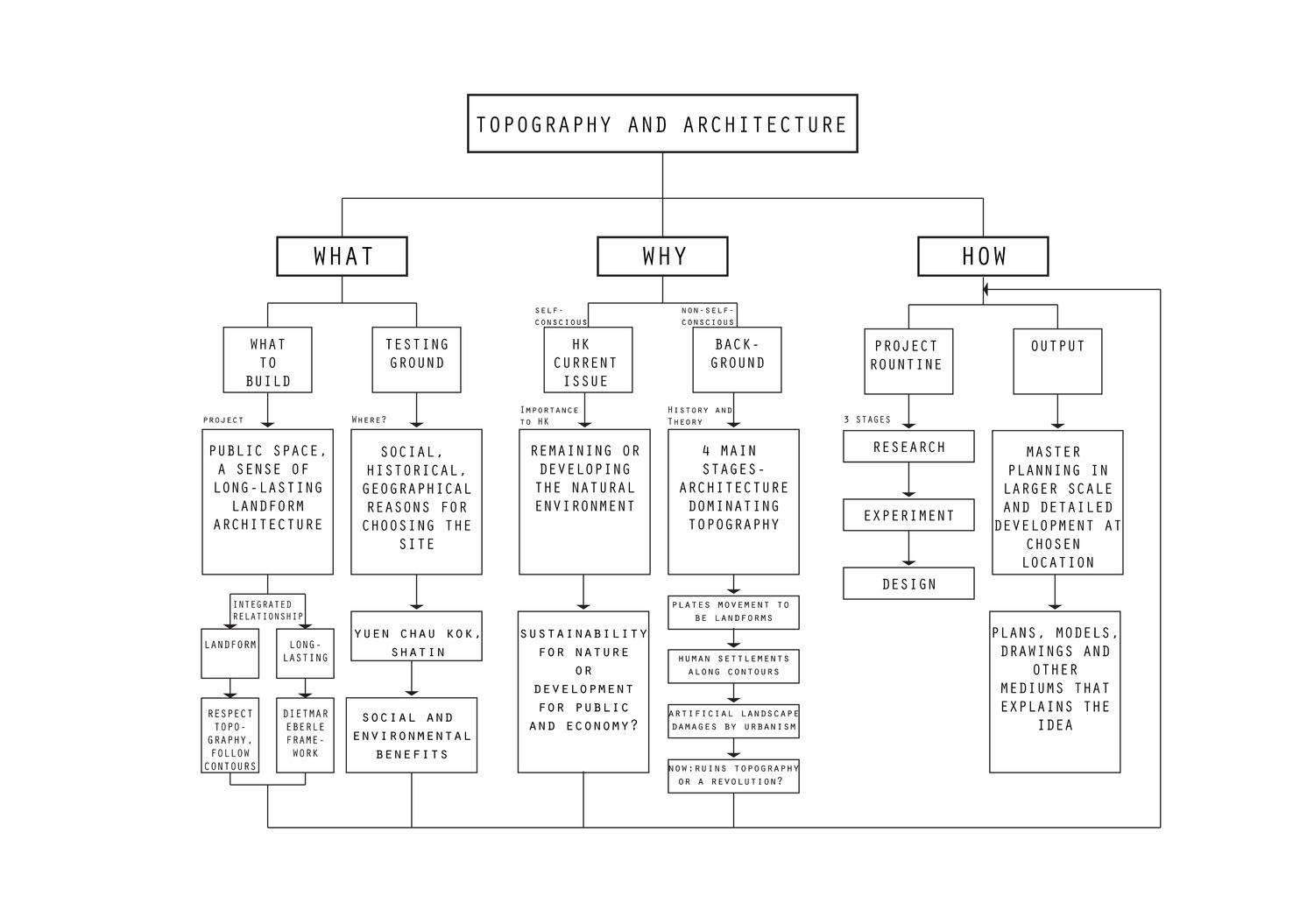
Artifact, self drawn. Thesis Brief This thesis is to design a public space, a sense of long-lasting architecture on part of the landform. Challenges are to respect the historical,ecological and geographical contexts behind the topography. It has referenced the framework of “long-lasting architecture” suggested by Professor Dietmar Eberle, in the order of “place, structure, facade and programmes”. Yet, this thesis aims to invent possibilities in sustainable landform that “long-lasting architecture” would benefit to. The integrated relationship between architecture and topography would be re-determined. Thesis Chart
Thesis Chart, original drafted. Indicating the flows of what, why, how under the topic
What?
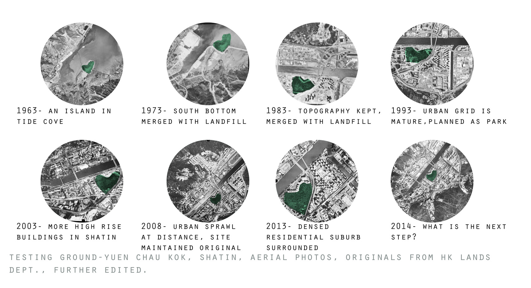
Testing ground- Yuen Chau Kok, Shatin, aerial photos, originals from hk lands dept., further edited.
Researches point Yuen Chau Kok as the testing ground. The site was originally an island in Tide Cove, which was used as a midway station between Kowloon and Guangdong. In the 1970s, with the planning of new residential suburb “Shatin”, it was merged with ground by landfill. In 1980, it was arranged as the largest temporary housing area. In 1993, a bottom part of the site is developed as a park, while the rest is remained as original landscape with minimal paths for walkers. The old house at Wong UK village is listed as declared monuments. Urban planning has dominated part of the original appearance of the site, luckily contours and natural landform are yet maintained. Shatin has the largest population in Hong Kong, as a dense residential suburb of 630,273 people. (2011 HK government Statistics) The density of public spaces are reaching their maximum. The social concerns push urban sprawl for extra spaces. Developing the nature arbitrarily results in damaging the valuable natural contexts. A balance in-between development and sustainability is important. It is now or never to take a revolution on the site, to tracking back the original contexts and leading to a long-lasting future, environmentally, socially and architecturally.
WHY?
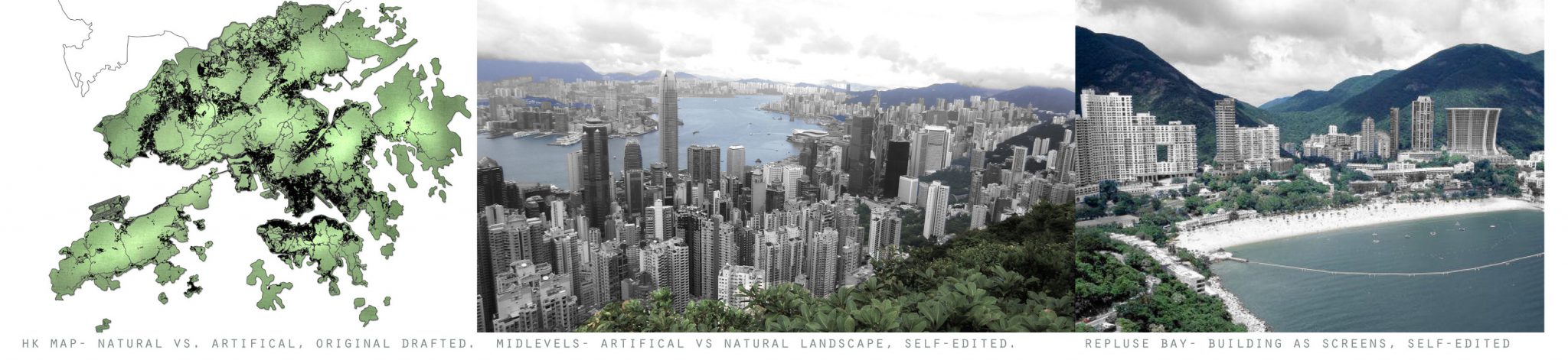
LEFT : HK map- natural vs. artifical, original drafted. // MIDDLE : midlevels- artifical vs natural landscape, self-edited. // RIGHT : repluse bay- building as screens, self-edited
Remaining or developing the natural environment is a debate between natural sustainability and city development recently. In fact, the bargain between human and landform already exists since the origins of life. Looking back to ice age, plates movement occurred and created landforms. There is no “Absolute Flat Surface” existing on earth. Then why are we architects designing buildings ideally with even landings? This is not obeying the natural rules. Human settlements started along the river and inhabited regions on planes. Houses and infrastructures are settled following the topography, generating artificial patterns on contours. Contours can be interpreted as “tree rings”, recording layers of time in human history. The well-recorded “contour tree rings” lasted until we have started to have suburbs, cities, which generate large flatness on surfaces. This is the urbanism revolution on ground. Settlements destroyed the original landscape and remained the hills along. This phenomenon is common in Hong Kong. It provides Hong Kong an artificial landscape, an authorised topography, with precious natural landscape remained. Architecture had dominated topography, which was non-self-conscious. Back to the issue – remaining or developing the nature, that should be a balance in-between. My interpretation of balance is a landform architecture,to design following the topography. By respecting the contours, architecture actually protecting the original contexts of earth and the habitats. In other means, architectural development could take place in natural landscape but be long-lasting, with well planning in building permanence and original topography. It is now the time to take another movement in topography, generating a new revolution at the “contour tree rings”.
HOW?
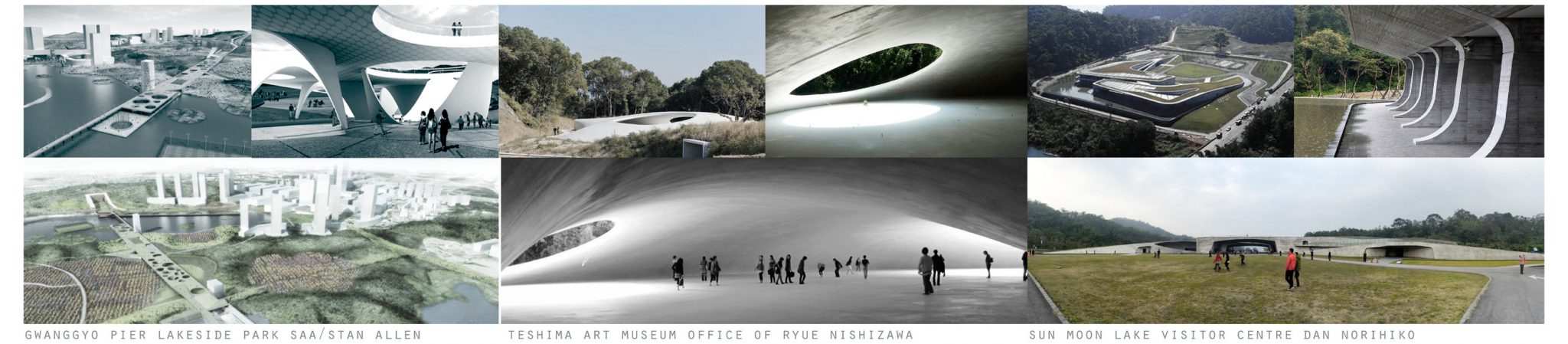
LEFT: Ggwanggyo Pier Lakeside Park by SAA/Stan Allen // MIDDLE: Teshima Art Museum office by Ryue Nishizawa // RIGHT: Sun Moon Lake Visitor Centre by Dan Norihiko This project will firstly do planning and researches on the testing ground in a larger scale, and later zooming in a specific location on site for architectural development in details, which focus on a output shooting geographical/ ecological sustainability, and long-lasting public architecture. The thesis would be developed along three stages, as listed below: Research stage Research/ Mapping on the testing ground – Yuen Chau Kok Precedent studies – landform architecture proposals Social studies- Shatin public resources and distributions Experiment stage Scenario Studies – relationship between topography and public architecture Long-lasting architecture theory experiment- place, structure, facade, programs Design Stage Designing the actual proposals for the site: a long-lasting architecture in the landform, in response to the geographical and ecological sustainability Producing panels, models for exhibiting the concept
Bibliography
|